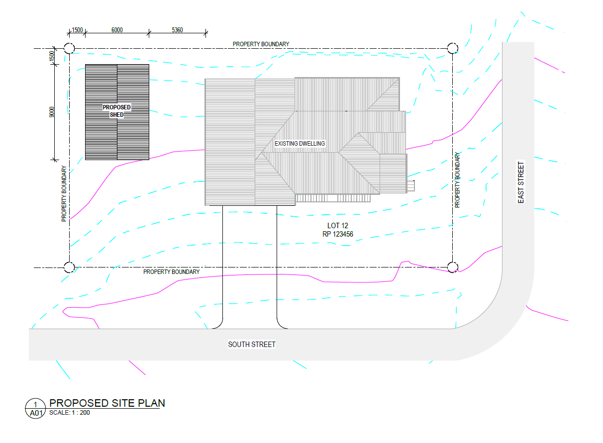
The Standard Site Plan offers a comprehensive overview of your property, detailing boundaries, existing structures, roads, driveways, and vegetation. It goes beyond the basics by also mapping out future planning structures and underground infrastructure, providing you with a complete visual guide to current and potential developments. This site plan is ideal for projects requiring a thorough understanding of the land’s natural and built environment, ensuring that your plans align with all key site elements.
With the Standard Site Plan, you gain a valuable tool for advanced planning and decision-making. Its detailed presentation of both visible and underground features helps avoid costly mistakes during construction, while also supporting compliance with local zoning and development regulations. Whether you’re managing a complex build or simply need an in-depth layout for future planning, this site plan ensures all aspects of your property are accounted for, giving you a clear path forward.